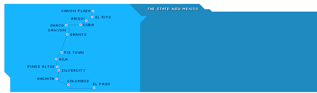


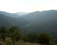
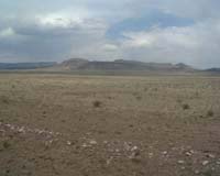
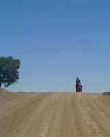
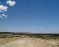
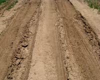
![]() 0km - 144km
0km - 144km
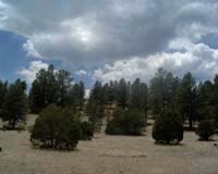
![]() Day 01, 28th May 2003
Day 01, 28th May 2003
144km (89miles)
"The Colemans camping stove fuel, sets fire to anything
- they just forgot to label it Napalm"
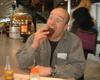
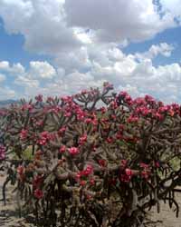
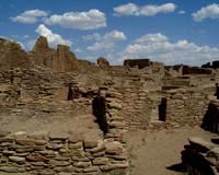
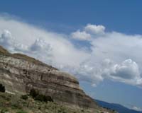
El Paso, figuring in ZZ Top hits, is a sleepy laidback town (1million)
literally on the border with Mexico. Five boot factories, 2nd largest US Army
encampment (Fort Bliss), and three border crossing bridges linking Ciudad
Juarez with El Paso. Each day some 50,000 people cross the border. Phantastic
burgers...
First heading downtown on the Montana, then taking right on the Mesa Avenue,
we start climbing out of El Paso, soon to exchange the hot & dry Texas weather
for the hot & dry New Mexico weather, we're all too happy to have changed
the tires from normal tubing to gel-filled tubing - here in Thorn Country,
the cactus have led to in total seven (7) flat tires in two days!
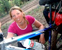
The BOB trailer arrived safely yesterday to our motel - the UPS tracking stated
arrival 05.42, left for delivery 06.45 - all to follow on internet, indeed
at 12 o'clock I was in possession of a Fat-BOB, plus waterfilter.
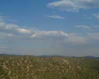
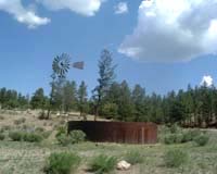
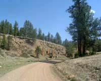
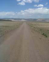
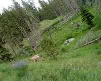
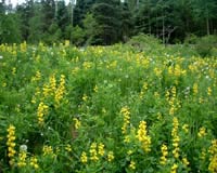
Following the Country Club Road, we eventually leave ELP behind us and cross
Rio Grande into New Mexico. Here the big river is rather wide but not
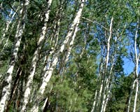
especially grande. The scrubs and low growing trees are doing the best they
can to survive, the roads are very wide and without much traffic. In the 144kms
to Columbus, we count to one yellow coyote, one brown snake, one desert rabbit
- all living in the hereafter, but we also see a majestic Golden Eagle hunting
and live bugs-bunnies racing around. This first day the water is finished
long before Columbus is reached.
 On Schiphol |
 Tired... |
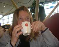 Last Dutch cofee |
 |
 First real american breakfast |
 El Paso |
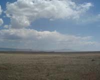
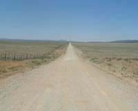
![]() 144km - 218km
144km - 218km
![]() Day 02, 29th May 2003
Day 02, 29th May 2003
74km (46miles)
"I wouldn't even take my dog there"
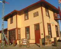
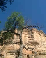
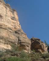
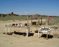
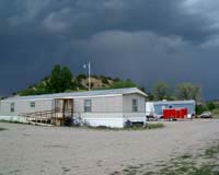
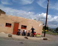
Columbus, border town of New Mexico. One hundred year ago 800 citizens,
today 800 citizens. Has a tire shop and a gas station doing good business,
a fire brigade and one police patrol. Further is there the old railway station
building, the old customs building and the old Camp Furlong building, and
a lot of portable houses and caravans.
The old customs house next to Camp Furlong is now a very nice camping, with
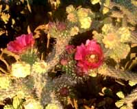
a good selection of some of the cactus to be found here at the northern parts
of the Chihuahuan Desert.
What actually makes Columbus worth the visit is not only the ice-cold coke,
but the transformation of the old station building into a museum covering
the historical raid of Pancho Villa in 1916. The mexican revolutionary had
had enough of US letting mexican troops use the border railway, difficult
arms policies and a temptation of a bank just across the border. So he led
500 men in an attack on the 13th Cavallery in best wild west style. The attack
was deflected, and under the leadership of Black Jack Pershing, US troops
retailated and ventured 800km into Mexico. Wasn't it for the WWI, there could
well have been a second US-Mexican War. Now it resulted in bloodshed, a last
cavallery strike of US Army and the first use of US aircraft in military operations...
A few miles on the other side of the border, the mexican town of Pamesa
(13,000) is situated. Where maybe half of the population in Columbus have
mexican surnames, it is not completely without friction that they look upon
the town on the other side of the border. With heavy industry closing down,
reorganising, or down-scaling in US, it's one thing what they do in Washington
and another outside the corridors of power. Otherwise formulated " This
country is going down, all the mining here is closing because of cheap labour
elsewhere. We have no industry here, some 800 people who lives here in Columbus.
And in Pamesa maybe 12,000 or 13,000 and they have no jobs either. I wouldn't
even take my dog there... "
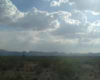
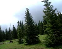
Saying hello to three cyclists touring down to Pamesa from Colorado. Our journey
goes west towards Hachita, we follow a ridge - with excellent view
of the high desert. Blue skies, in the afternoon some clouds. Pass two ranches,
and take an apple-stop in the shadows of a water tank before entering Hachita(50person).
Here we have the best muffins in the state - not to be missed! Whether digging
into the chocolade, blueberry or banana version, the taste is beyond ordinary
muffins. The camping at the back is pretty basic, but free of charge.
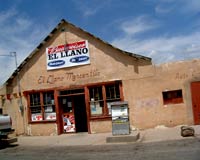
 Columbus museum |
 Columbus cafe |
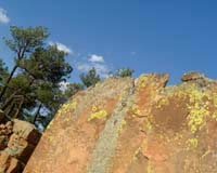
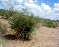
 Chihuahuan Desert |
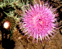
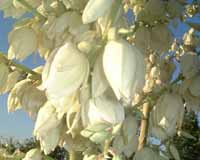 Cactus in bloom |
 |
 |
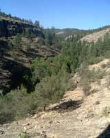
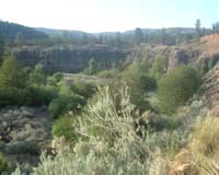
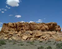
![]() 218km - 369km
218km - 369km
![]() Day 03, 30th May 2003
Day 03, 30th May 2003
151km (96miles)
"We like to change here very, very, very slowly"
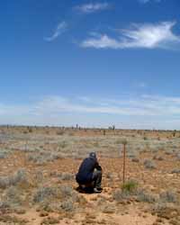
Up early, heading down to Antelope Wells and back in one day! One way
is +47miles, and it will be hot here. After some cerials and powder-milk,
topped off with a muffin the wheels are turning at 07.10 direction south and
Big Hatchet Peak. A quick stop at the Post Office, past the white-washed catholic
church (where half a dozen very dead pigeons decorate the entrance), we leave
the barking dogs behind us.
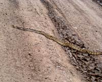
Make a first encounter with a big rattler, dark brown and over-run. Imagine
to find one of them in your way, when you just wanna brush your teeth... Thus,
lesson one: stay away from tree trunks, poles and shadow, and in the night
time rattlesnakes like the heat of the asphalt, thus keep your eyes open and
use a flashlight when it's dark. Hmmm, let me see, tired cyclist normally
want's shadow, lean your back againsta a fence pole and sit on a tree trunk.
This may pose a problem, good to know that they only have serum in El Paso.
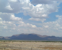
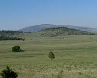
This is cattle country, but you won't find more than eight (8) cattle heads
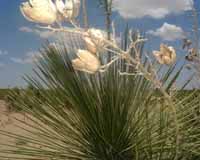
per square mile (3.3 square km). Low growing cactus and grass, yucca clusters
looking sub-human from distance and 40 degree in the shadow - that is no-where
to be found. The valley gets more narrow after we've passed the pass between
Big and Small Hatchet Peak. An old ranch now taken over by cows. No traffic,
but a wide roadway down to the borderline.
Two thirsty cyclists arrive at the outpost at lunch time. Get's a very welcoming
handshake by the two customs officers keeping an eye on the border. Discussing
pro's and con's between Alaska, Antelope Wells and El Paso over a magnificent
hamburger and a cool coca-cola, our start-off point on the Great Dividing
Range Mountain Bike Route is perfect. More so as we learn that in the rainy
month of August the tarantulas are crawling all-over the place, and now only
rattlesnakes are in season.
- From here we only go north! Refreshened, we set out towards Hachita. Suddenly,
a few km's ahead of us, a lightning bolt cuts through the air like a laserbeam
and a pre-seasonal thunderstorm let some rain droplets fall at Big Hatchet
Peak. Half an hour later we're there and it's all dry. The last 20km's are
very tuff, this is still the start and our gentler parts are not completely
used to hours in the saddle. In Hachita we're welcomed by Lucy, Jim and Amy
at the cafe. Actually we're probably the last cyclists for the season setting
out from AW, and only from August there will be Great Divide riders here again
- but then completing the trail.
 |
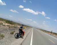
 Hachita |
 To Antelope Wells |
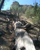
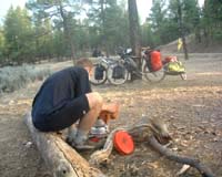
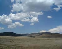
![]() 369km - 439km
369km - 439km
![]() Day 04, 31st May 2003
Day 04, 31st May 2003
70km (46miles)
"Is this the road to Silver City?"
Got up slowly, packed our gear and enjoyed a last muffin before setting out
into the Chihuahuan Desert again. At the cafe, Amy is starting to prepare
for the festivities of 4th of July - when whole Hatchita is partying, and
a whole air-force contigent is expected. We leave the small town with the
big heart, and head into Apache country. Up to Separ, the high desert
looks even drier, and swallows are the only ones singing for us as we pass
the great divide for the first time at 4096ft.
After a chat with a race cyclist turned truck driver, who used to cycle California
- El Paso, we cross the freeway and Western Pacific Railroad and hit the dirt
road leading north. Today and tomorrow we're still in the Chihuahuan Desert,
at a ranch we check and ask for the way to Silver City, which we will
reach after a night in the wide open. Followed by two happy sheep dogs (but
there is only cattle here around...), we pick a small ridge for our tent overlooking
the most surrealistic landscape - cactus, mountains at the horizon and some
cattle just below from us. No risk of starting a bush fire as the burner is
left in Hachita...
 Hachita pomp |
 Hatchet mountains |
 Big Hatchet Peak |
![]() 439km - 497km
439km - 497km
![]() Day 05, 1st June 2003
Day 05, 1st June 2003
57km (37miles)
"I didn't realise how different it is in Europe"
A cool 21 degrees in the morning, and we eat our cerial with a crow watching
us from a cactus branch. - You just expect someone to say - Cut, next shot!
This is as much wild west you can get for your money. Followed our trail maps,
and at a Y-crossing, I take a bearing on Burro Peak, still the map
is hard to read without any real height curves. Take the right turn. The landscapes
is becoming more hilly, with some good uphills and speedy downhills. Where
loose sand sometimes appears at the bottom of the downhills - fat-BOB is going
left to right and the whole road is used to stay upright...
All of a sudden we arrive at a ranch, where we can get water refilled. Fortunately it is not the dead-end as it looks,
but the road continues beyond the ranch up to the Interstate 90 that will take us the last miles to Silver City. As we hand
over a water bottle, we learn that the youngest cowboy in the family is just back from Ireland, that they get good pigs
from Montana and that a ranch actually looks much like what you see in them Country & Home lifestyle magazines, but then
real - complete with stuffed animals!
Entering Silver City (12,000) we find a perfect camping. Actually a
place for motorhomes, they have a patch of grass and it's in the centre -
just behind Food Basket. Food Basket is of course the local supermarket -
with all the food you can crave, and even on a Sunday it's open to 21.00!

![]()
![]() 497km
497km
![]() Day 06/07, 2nd to 3rd June 2003
Day 06/07, 2nd to 3rd June 2003
0km (0miles)
"How do you see the difference between a Mexican
and an Indian?"
Two lovely rest days in Silver City. With it's old western centre, boutiques
and excellent university library, we rest, update the website and eat all
the things you cannot find in the coming five (5) days in the bush. This was
the hometown to Billy the Kid and the town has seen indian raids, floods,
silver booms and gold fevers. Basically a mining town, the copper mine worked
since the spaniards got to hear about it, now with the mine closed it looks
for tourists and senior retirees. Also artists, environmentalists and harley
riders seems to have found their way here.
 Working! |
 Postboxes |
![]() 497km - 559km
497km - 559km
![]() Day 06/07, 4th June 2003
Day 06/07, 4th June 2003
64km (41miles)
"There is always one more crest to scale before you're
at the top"
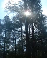
Goodbye high desert, hello mountain ridges! Quickly leaving Silver City behind
ourselves, inviting hills are guiding us upwards. Step by step the landscape
is becoming more forrested and after reaching the crest, Pinos Altos is quite
suddenly entered. Originally built up around a gold gulch in the 1860's it
was frequently under attack of the Apaches and Mangas Colorados. The most
prominent feature is the Buckhorn Saloon from 1803, and one of the wild west
Opera Houses of some reknown - but these only opens at 15.00hrs so we continue
rapidly in a series of downhill rides, on towards Gila Cliff Dwellings.
At Lake Roberts we get ice cream accompanied by humming birds (colibris)
constantly in flight, and raiding water fountains. From here a decent climb
takes us higher, then another climb, and a third, but the day is closed with
a 5 mile downhill - leaving the brakes and wheelrims burning. Camp side is
picked just next to a side stream of the Gila River - and the day is closed
with a splattering bath in a stream that actually has fresh, streaming water!
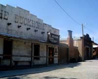 Gost town Pinos Altos |
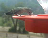 Humming bird |
 |
![]() 559km - 624km
559km - 624km
![]() Day 06/07, 5th June 2003
Day 06/07, 5th June 2003
65km (42miles)
"You better do the divide with someone you really
know, or really want to know..."
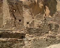
The birds are singing already at 05.00, and after an hour of turning in the
sleeping bag, tea is set and the water filter is put to use - a lot of pumping
for some clean water (as you promised Mr. J). On the bikes and down into the
hidden valley where the Mogollon people had their cliff dwellings. We're the
first ones at 8 o'clock, a short but spectacular walk takes you around as
the sun gives a subtle light to the natural cave setting. A park ranger curiously
asks whether we saw the sleeping rattlesnake or not, coincidentally at a section
where we shot a video clip, passing the cold one 5 or 6 times...But no, 2ft
away was to far away to recognise it...
Then a murderous climb is taken on. The 5 miles downhill of yesterday now
has to be repaid, sometimes at +10% inclination, and continously ascending.
That's why the 700year old dwellings are such a well preserved secret. Fortunately
a cooling rain shower takes away the worst heat. The subsequent downhill is
well deserved. - Rock Canyon on bikes! now, let me tell you one thing,
there are bolder this big (shows with his hands) and I've been cutting timber
up there - on a bike, not possible! After these warming words, two cyclists
set out for Rock Canyon and Black Canyon. Tomorrow will tell, we get a beautiful
sunset at our campsite, literally on top of the Great Divide - from here it's
only west or east, we're at the influx, the centre, the physical divide of
dreams as well as water.
 Cliff dwelling |
 |
 Gila forrest |
 |
 Cliff dwellings |
 Campground Collinspark |
![]() 624km - 676km
624km - 676km
![]() Day 06/07, 6th June 2003
Day 06/07, 6th June 2003
52km (34miles)
"The wild west would never have been won if they
would have had water filters back then"
Following the crest of the Great Dividing Range, the first few hours are easy,
but what awaits in Rock Canyon? Carrying the bikes? A fast decent on
gravel roads let us enter the canyon floor, where the pine forest stands tall.
The official campsite here is a lush green, a pheasant runs across the road,
crossing a few dried out streams - there are sections with sharp rocks, but
giant boulders are not to be seen... Climbing out is a very sweaty job though.
Straight up, on serpentine roads.
Before continuing to Black Canyon, lunch is taken at an old Alligator
Juniper. Descending into the green valley with lava black basalt sides called
Black Canyon, some soft sand is encountered - which results in a soft, controlled
touch down. Nothing broken, no injuries. Black Canyon carries water, and supposedly
Gila Trout. The second serious climb today is longer, but on better (gravel)roads.
the first 34 miles of +120miles wilderness are covered.
 |
 |
 Rocky Canyon |
 Wall Lake campground |
 Sunset at campground |
 |
![]() 676km - 746km
676km - 746km
![]() Day 06/07, 7th June 2003
Day 06/07, 7th June 2003
70km (44miles)
"Life is not only a series of downhills"
Woke up at 04.00hrs, freezing cold - a mere 8deg. Celsius, to be compared
with overday temperature between 24deg. and 34deg. - life is hard for the
camper. Two quick 300ft climbs and even fast down, playing the cowboy as the
cattle starts moving at the sight of man on bike. Wall Lake, idyllic,
green grass, cattle, rock wall staright into the water and - signs of NO TRESPASSING,
NO CAMPING, NO HUNTING everywhere!
At Beaverhead Workstation we get a good insight in how modern firefighting
and forest services works. Leaving the forest behind as the cycles are turned
into VERY strong head winds in O-Bar-O Canyon. Find a spot at pine
tree covered Elk Mountain - where we catches a glimpse of a grazing elk, just
as we finish our rice with mexican oregano and onion dinner. The first 34
miles of +120miles wilderness are covered at the end of the day, but if this
will be the average on dirt and gravel roads, we'll have problem keeping the
schedule.
 Big climb in the morning |
 Goodmorning Beaverhead |
 |
 O-Bar-O Canyon |
 W..a..t..e..r.... |
 |
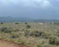
![]() 746km - 809km
746km - 809km
![]() Day 06/07, 8th June 2003
Day 06/07, 8th June 2003
63km (41miles)
"All the crazy people live up in Montana"
Wonder where that solo cyclist went with his BOB trailer? He passed us yesterday
- extremely focused, and didn't even seem to notice our tent. Maybe we'll
catch up with the shadow ahead of us? Again emerging out of pine forest, and
crossing some 4km of praire at 7,440ft (2,269m). The descent through the narrow
and winding Jolla Canyon goes swiftly, and all of a sudden the Plains of
San Augustin are there - flat ancient sea bottom, once hit by meteorite
showers, today ranch country.
Turn them wheels, pedal on, always in motion, yet no sweat to mention - it
all goes into thin air here with this hot, dry air. Always thirsty thoigh,
and as one of them so popular big, jeeps stops and let the V8 go quite for
a minute, we meet up with a New Mexican on his return from a trout fishing
weekend in Arizona. He's happy to swap tales and fill up our water containers.
- But, what are the two of you doing in this desolate spot? Here is nothing!
- So, heading up to Montana? - Hmm, there's a lot of strange people up there,
you'll see for yourselves. Later at the intersection with a small paved road,
some cowbouys in full gear are enjoying their Sunday outing at the church
- kids playing volleyball, women on the porch, and these three big buckles,
all boots with spurs and cowboy hats are happy to explain that an average
ranch herearound is 60 to 100 sections, one section is 64acres and one acre
is about 2.2 hectares. Plus that there is about 10 cattle per section. A late
afternoon climb into Apache National Forest before we go to bed with
the coyotes howling at distance. No sign of the cyclist though.
 Plains of San Augustin |
 |
 Wind |
![]() 809km - 870km
809km - 870km
![]() Day 06/07, 9th June 2003
Day 06/07, 9th June 2003
66km (38miles)
"That's neat"
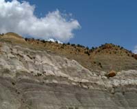
Decending into the high plateau to the north of the Mangas Mountains,
leaving Apache National Forest behind us, a pre-seasonal thunder storm is
slowly building up. At first only the mountain tops are getting a beating,
pitch dark clouds, flashes, thunder bolts and roaring thunder - at distance,
is coming ever closer. Heavy raindrops start to fall, flash-thunder 1.2km
away, 1.5km, 800m and 600m - then we sit down at the road side, away from
big trees. Two hours later the ridge called Hogs Back is guiding us
into Pie Town (60) - the town famous for - yepp, pies...
Here we finally meet up with Anthony, the cyclists we watched pass us on his
way to Collins Park. But first of all we are picked up by Nita, as
our arrival have been announced - by both thunder and lightning, and the occasional
farmer heading for her mail at the post office. Pie Town does have great pies,
in fact two cafes serving them, and the natural meeting point is as expected
the Post Office, but much more welcoming and surely more unexpected is the
warm welcome at Nita and Don's home. Here most hikers and bikers have the
warmest of showers, and best of company ever wanted for. In addition she gives
the three of us a tour of the town, including the Very Long Array - a NASA
telescope places in Pie Town due to it's unrivalled clear air, or perhaps
just because that even engineers loves apple pie?
 Rain is comming |
 Brrr, cold and a bit scared |
 Just before Pie Town |
![]() 870km - 940km
870km - 940km
![]() Day 06/07, 10th June 2003
Day 06/07, 10th June 2003
70km (45miles)
"Pie Town is the Centre of the world"
A bit late on the road, after a double breakfast. First some tea at Nita's
and as the cafes were closed yesterday, the must-have-done pie in town. Todays
ride turns out to be much faster than expected. Good roads, open ranch country
and more cattle than people encountered. - How far to Pie? is the eager question
of the two city ladies lost on the back roads of New Mexico - afraid of running
out of gas.
Mainly downhill and as we arrives at the last paved 10 miles to the Narrows
Anthony cathces up with us - as he departed a bit later. At the parking
and camping ground marked the South Narrows, we climb the sand stone formations.
From this airborne view, the true phantasm of El Malpais is revealed.
Only about 2000 years ago, lava protruded from below and cooled off very quickly,
and the magma reshaped the valley floor - and froze as it cooled off. From
above the cracks, horsts and reshaping of the prairie is fixed in time. The
planned sleeping under the stars uwithout a tent is rapidly surrendered as
we have a visit of a desert rat.
 |
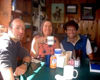 Bjorn, Nita and Anthony at the cafe |
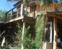 Nita's house |
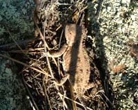 Horned lizard |
|
 |
 |
 |
 |
![]() 940km - 1007km
940km - 1007km
![]() Day 06/07, 11th June 2003
Day 06/07, 11th June 2003
67km (43miles)
"We're specialized in burgers..."
Continue down to Grants turns out to be a relaxing ride on paved road
- with El Malpais to the left and a long ridge on our right hand side. A stop
at La Ventana, a sandstone arch and a small item shot regarding a certain
rattler in quite cool weather - not more than 24 degrees. After 8 days of
continuous cycling we reward ourselves with a cool coca-cola at the intersection
with Route 66, today Interstate 40.
Grants (10,000) is a trading post, turned uranium mining boom town, turned
truck stop, is a town good for restocking and a day of rest. Most exciting
is the Pedro's restaurant along the freeway, and poor sod who happens to live
here without a car... Everything is outside of the town, which naturally lack
a centre ville. Found a Mexican to eat at. - Oh, you guys want to eat. - We
sort of specialise in burgers. - The french fries machine broke down yesterday.
Sallad? - no. Fajitas? - no. -Actually we only have regular burgers. But the
cook was friendly enough to direct us to Pedros. Excellent sallad buffe, and
big burgers - even with french fries if you like. Must be one of the biggest
truck stops on the West-East route, at least 50 or 60 big 18 wheelers parked
at the back.
 Road to Grants |
 Up and down... |
 |
![]() 1007km
1007km
![]() Day 16, 12th to 13th June 2003
Day 16, 12th to 13th June 2003
0km (0miles)
"Grants - mining town turned truck stop."
Two full rest days, where also the bicycles get a complete run through - brakes,
derailleur and most important wheels. At the library of the university we
again have access to internet, which turns out very handy. At the Blue Spruce
RV Park, or designated camping, we also run into Mike-the-biker. Not only
is he the happy owner of a Harley or two (give or take 7) he also hook up
a funny little trailer - which correctly timed takes him 2hrs to unfold. But
then Mr. M. can sleep in a queen size bed, watch TV and even have a cold soda-pop
from his fridge. All bikers are not the same, but they're all different.
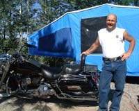 Mike the biker |
![]() 1007km - 1096km
1007km - 1096km
![]() Day 17, 14th June 2003
Day 17, 14th June 2003
89km (58miles)
"Better you than me, I guess!"
After a good nights sleep and a giant breakfast, we head down to the General
Post Office of Milan - the satellite of Grants. Here, the post office
haven't changed the last decades, and all the wall space is taken up by mail
boxes. In the far away corner a small locket is serving the customers, and
one of the girls from Grants General Post Office appears behind the counter!
This Saterday we get rid of 18lbs of surplus gear, including long sleeved
shirts, read out books and a rope for climbing.
Just before entering the freeway, our bikes are turned northwards and we follow
the long, drawn out ridges direction Chako Canyon. The landscape is
similar to the Chichuchuan - a wide valley closed in by nort-to-south running
mountain ranges, and it is quite hot. A refreshment stop at the junction road
607/509 brings us unexpectedly into the live scene and biker bar of Grants
and surroundings! Modest climbs lead us up to White Horse and a night
in the reserve. As we turn off the torch, we go to sleep with the local gospel
choir singing in the distance.
 To White Horse |
 |
 |
![]() 1096km - 1163km
1096km - 1163km
![]() Day 18, 15th June 2003
Day 18, 15th June 2003
67km (42miles)
"This is the Great Outdoors!"
Here, in the open praire landscape, strong gusts of wind can give you some
difficulties on the bicycle, and just like last night. also keep you awake
and wonder whether the tent is well pinned down. All the way to Seven Lakes
the road is paved. There, where no lake is to be found, where the old shop
is closed down, the right turn takes you right onto a rocky, boulder stuck,
corrugated, washboard of a dirt road. This will bring you to Chako Canyon,
the oldest architectural/historical site of USA. As we arrive at the actual
site, the display loop has a nice asphalted surface to it, and the ice cold
coca-cola goes down very easily in the 38deg. afternoon sun. Once, home to
the Anasazi Indians, contemporaries with the Mogollan people to the south,
the pueblo ruins are distributed throughout the steep sided valley. This side
trip may cost a day or two, but the scenery and historical ruins are well
worth it.
 Road to Chako Canyon |
 Little shop down the road |
 |
 The Canyon |
 Chako Canyon |
 Anasazi Indians lived here |
![]() 1163km
- 1267km
1163km
- 1267km
![]() Day 19, 16th June 2003
Day 19, 16th June 2003
104km (65miles)
" Nobody will really say anything..."
With only the inner tent to pack, the morning cerials are quickly downed.
A hello goodbye to our immediate neighbours, a small directional fault leading
us into the valley, instead of out of, and there we are two happy cyclists
on the road again. After two (2) miles, the tires dig into the badly corrugated
dirt road, but today is a bit cooler - just a mere 32deg. in the shadows -
of which there are none... Most of the day is going through indian reservation.
A lot of scrubs, ridges, hidden green river valleys - but where the river
awaits the yearly monsoon normally starting in July.
At Pueblo Pintada, the tough dirt road is exchanged for pavement. The
rolling landscape both gives and takes our energy. In the late afternoon dark
thunder clouds build up - but stay in the distance. Where we started with
rough riding, we end the last miles to Torreon on a new paved rollercoaster
ride, with heavy gusts of side wind sweeping us left and right. The tent is
pitched just behind a small little hillock, barely on federal land - but herearound
nobody will really say anything about that.
 Bjorn Zoetemelk... |
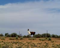 A lama |
 More rain on the road to Torreon |
![]() 1267km - 1317km
1267km - 1317km
![]() Day 20, 17th June 2003
Day 20, 17th June 2003
50km (31miles)
"You will be cruising."
Wake up to the sound of horses and barking dogs, have warm cup of coffee at
the gas station - our service hous of the day. Just like we're told yesterday,
the road to Cuba is general downhill cruising. It brings us through
some imposant rock formations, sand stone on top of younger magmatic rock,
banded in layers, odd stones that are half sunken into the lava before it
solidified. In Cuba (300) Pedros mexican food tastes excellent, especially
together with a ice cool Cerveza.
 Road to Cuba |
 Just before Cuba |
 |
 At the RV-Park |
 After our 'highpresure' shower |
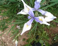 Flowers everywhere |
![]() 1317km
- 1382m
1317km
- 1382m
![]() Day 21, 18th June 2003
Day 21, 18th June 2003
65km (40miles)
" That's why it's so green here..."
The mountain road, past the tourist info is steep but paved for the first
15km, thereafter a good gravel road - even steper assures a steady 750 altitude
meter climb of today. Before leaving we've stocked up on water, as the water
around Cuba is contaminated by heavy metals (lead etc.). Overcast, lunch in
rain, then some sun as the road narrows and gets more winding - from the dry
but green valley, to deep mysterious forest in a few hours. Overall birds
singing, woodpecker hacking away and an elk that quickly turns at the sound
of cyclists approaching. At a green meadow, the tent is built - saving us
barely from getting all wet. This dinner is cooked inside the tent under cover
of the big front aisle. Coyotes howling as the temperature is getting down
to 10 deg.
 Oh..oh wrong road |
 So green! |
 |
![]() 1383km - 1453m
1383km - 1453m
![]() Day 22, 19th June 2003
Day 22, 19th June 2003
71km (44miles)
" Who said the rains come in July and August?"
Early, as the sun dispersed the morning dew, I look out over the green clearing
opening up in front of our tent. With 8 deg. inside the tent last night, it
cannoit have been that many degrees above freezing outside. The climbing roud
continues through deep forest, with the occasional clearing. Sometimes we
round up cattle, encounter the odd cottage or small ranch, but more of deep
spruce forest - every now and then opening up to the valleys deep below. At
3000m it planes out, and we are caught in a hail storm, which incidentally
turns into a light rainy/snowy mixture before long! There is a saying in New
Mexico - If you don't like the weather, just wait 15 minutes...
Fortunately the extreme technical riding of the morning (uphill), was done
in dry conditions, and the downhill to Abiqui goes over a sandy, but
hard surface - suddenly we're down in the valley, with 30deg. and sunshine,
dry pine forest with the occasional cactus! Where we leave the National
Forest, the landscape opens up and in front of us lies Abiqui (1,000)
right at the foot of the steep mountain sides and start of open ranch country.
Instead of getting drenched in another pre-seasonal thunder storm, we enjoy
a hot cup of coffee, and can even put up the tent under a roof.
 Santa Fe, National forrest |
 More rain..snow..hail?? |
 It smells so lovely |
 Snow on the road |
 |
 Aspen |
![]() 1453km - 1508km
1453km - 1508km
![]() Day 23, 20th June 2003
Day 23, 20th June 2003
55km (35miles)
"Basically it is a very good road!"
In Abiqui, the gas station is both hardware store, bakery, lunchroom and cafe
- and the muffins are to be recommended. From here we follow the old Santa
Fe trail, mapped by the Jesuits while they where looking for a route of
transportation to the Spanish colony of California. El Rito is a nice,
neat place. Here the paved road goes over in dirt. Through pine tree forest
and rugged mountains. All of a sudden I alomost ride over a snake, right there
on the road. Almost a meter, and lazy it turns out to not have the few extra
bone rings at the tail end...
Shortly after lunch, we have to stop. Again, we find ourselves in a very active
and very close thunder and lightning show. It last but an hour, and then the
fun begins. These dirt roads have a reddish tint to them, the soil is laterite
with a large clay content. This results in a fat, rigid, all embracing mud,
which completely prevents our wheels from turning after only a few muscle
tearing meters. Only by leaving the road can we continue, cycling, pushing,
hauling carrying and cleaning the wheels. Brakes are superfluous, chains are
strings of clay, feet are slipping sliding around and the last 8km takes 4hrs
to complete. In Vallecitos we are greeted by chain dogs barking from
just about any house, shack or shed. No people around, everyone is to a school
baseball game - but for two boys that can give uys direction to a farm ahead
of us. One english mile further we enter a car cemetary of some reknown, and
are greeted by barking dogs. One half coyote, one Chow-chow (name origins
from the sound it makes upon welcoming a visitors leg) and a young bullterrier!
- But they are all happy dogs! The most outstanding hospitality is welcoming
us. The bikes are washed clean, a banana/egg/juice drink is forming our dinner
and the owner, Arnold, even let us stay in a spare room - first time in almost
a month in a real bed!
|
|
 |
 Big snake |
 Clogged up with mud |
 The road after the rain |
 Smile dear, and push! |
 Arnolds old car collection |
 Sleep-over |
 Nice squeaky bed |
![]() 1508km - 1577km
1508km - 1577km
![]() Day 24, 21th June 2003
Day 24, 21th June 2003
69km (44miles)
"That's where Burning Mountain get it's name from."
"It is very windy at the top."
Slept like a log in the castle of the mountain king! Hurriedly we get up and
dress - and are met with a heavy layer of frost outside! Just outside Canon
Plaza it's time for breakfast. Again as we ride through the small village,
dogs are barking and chasing after us - what do all these people have to be
afraid of? Hit the dirt shortly after, but this time in dry conditions.
Quickly we leave the valley below us, bathing in sunshine. Soon we dart in
and out of the pinetree shadows, with cicadas slowly starting to play, a quite
forest is hard to find. During the day, all the roads lead uphill but for
a few short modest downhill slopes. This includes a series of very steep absolute
breathtaking climbs, during one of them a lovely timber house surrounded by
green meadows and right next to a private small lake is passed. Eventually
we give in to the luncheon. Today it is summer solstice, Midsommar, the longest
day of the year - quite properly we celebrate it at a clearing with green
grass flowers and warm sun. In addition to the standard tortilla with peanut
butter, there is fish (tuna out-of-the-can) and a very warming Cotes de Bourg
- the gas station in Abiqui is also probably the only place in NM where they
have a decent assortment of high class French wines. Usually it's american
flagged, or at the best Australian or Chilean reds. Still climbing and a bit
flimsy, we meet recreational weekenders taking their Sport Utility Vehichles
(SUV's) for a ride/drive. There are four wheelers, three wheelers and the
occasional dirt motorbike - with dad, dad and kid, mom and kid, kid and kid!
Then the crest is passed, past the so-popular camping site of Hopewell
Lake, onto bitumen - new speed record 66.3km/h on excellent roads. Then
dirt road for the last few hours, into beaver country (no beaver seen), past
Cisneros Park and all of a sudden we're cycling in the prairie again.
Straight on towards Chino Peak, there a sharp turn West and the last
few km's we have strong head winds. Campsite is chosen in a low dip covered
by some bushes, slightly out of the wind. Last sip of wine to accompany Beef
Stroganoff out of the bag. The coyotes howl, can the day of light be celebrated
better?
The top

Just an old house
Beautiful(but tuff) climb
Weed ![]()
![]() 1577km - 1626km
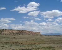
1577km - 1626km
![]() Day 25, 22th June 2003
Day 25, 22th June 2003
49km (31miles)
Todays first 20km's are swiftly covered over modest graded, good gravel roads.
We are continously darting in and out of small woods, white aspen stands,
dry pine tree clusters and out in wide, wide open grassland. The whole day
are mainly spent in lowest gear though. Like yesterday, series of very steep
slopes are making us sound like a hart patient after a marathon run. Getting
closer to Brazos Ridge, it get's very windy and a bit cold. Look! Renate
has spotted two Mule Deer, just below a ridge for me to see. Video camera
out, slow approach, and yes there they are again - but very wary! At 100m
distance they suddenly sense us and darts off.
On top of the mountain, there is Carson National Forest to our right,
and Cruces Wildernass Basin below to the right. Blue skies overhead,
not a house to be seen - and snowdrifts in New Mexico!!!. Then down through
pine forest, first 15km on extremely steep road covered with sharp boulders,
rock and bedrock outcrops. Tonight, camp site is at about 3,000m altitude.
With enough dry wood around we can treat us with a warming fire as the stars
are slowly coming out to watch over us. This is the last night in New Mexico
for this trip. The Enchanted land is really that.

Cruces Wildernass Basin 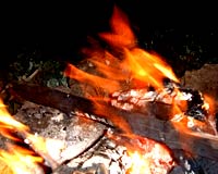
Finally, our first fire!![]()