


| New Mexico: Antelope Wells (Startpunt en Grenspost met Mexico), Hachita, Separ, Silver City, Santa Clara, Hanover, Mimbres, Pie Town, Cuba Abiquiu |
|
|
 |
|
|
|
New Mexico | |
|
|
 |
|
|
| Colorado | |
|
|
 |
|
|
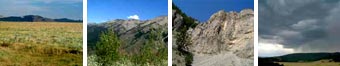
| Wyoming | |
|
|
|
|
|
Discovery 1st where West of the Great Divide. |
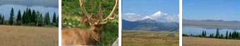
| Idaho | |
|
|
 |
|
|
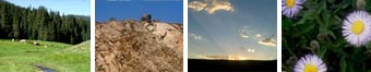
| Montana| |
|
|
The route is the longest mountain bike route in America, spanning 2470 miles (3952 km) from the Mexican border up to the Canadian border. The route generally follows the Continental Divide, crossing it no fewer than 27 times. |
| Yes, there's some climbing - over 200,000 ft total (61,000 m). About 90% of the route is on dirt roads or singletrack trails - only 10% of the route is paved. |
| Click on the buttons on the map and read more about the states |
| Watercontainers |
| The normal waterbottles we use are just 1.5l softdrink bottles - gives you more water at hand. |
| Minimum drink water per person is 4l a day, plus any water for cooking and cleaning. To cover this in New Mexico, two MSR waterbags are employed - 4l respectively 6l. The MSR water-filter fits, and can also be used as a field shower. |
| Wheel & Tyres |
| The standard MTB wheels are often built more for light-weight than for the heavy loads of camping gear and water bottles. |
| Use tyres with knobs on the side only when going on asphalt. With trajects of more than a day on tracks with soft sand, mud or rock, choose a full profile. |
| Foldable tyres with strong sidewall-long life & easy packing |
New Mexico
At the Mexico border near Antelope Wells, the trail crosses the grayish limestone outcrops of the Big Hatchett Mountains, winding north through the arid New Mexico desert before it reaches the rugged, forested mountains of the Gila National Forest, and one of our country's most spectacular Wilderness Areas, the Aldo Leopold. The Trail then crosses the Badlands ("El Malpais"), one of the best examples of recent volcanic landscapes in the U.S. Here the Trail coincides with the 1,000-year-old Zuni-Acoma trade route, crossing rugged lava flows. Before reaching Colorado, the Trail travels through the Cibola National Forest, dramatic canyonlands near the famous Ghost Ranch and the Carson and Santa Fe National Forests.
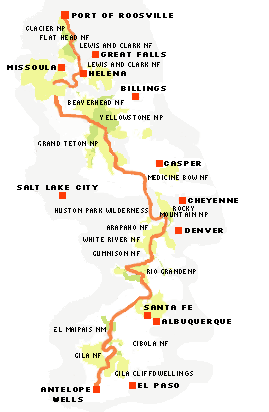
| Colorado: Platoro, Summitville, Del Norte, Doyleville, Sargents, Mears Junction, Poncha Springs, Hartsel, Como, Breckenridge, Frisco, Silverthorne, Radium, Steamboat Springs, Clark, Slater |
| Wyoming: Rawlins, Atlantic City, South Pass City, Boulder, Pinedale, Cora, Moran Junction |
| Idaho: 72miles or less than 3% of the trail |
| Montana: Lakeview, Lima, Polaris, Elkhorn Hotsprings, Wise River, Butte, Basin, Helena, Lincoln, Ovando, Swan River, Columbia Falls, Whitefish, Eureka, Port of Roosville |
| Research and mapping for the route began in 1994. The Adventure Cycling Association, commissioned Mac McCoy to set oto link existing roads and trails from Canada to Mexico. |
"Montana has the most of USA's total of 1,000 Grizzly Bears vs. Canada's 31,000"